
Joyce Mmereole Okoli
The management of the Nigerian Maritime Administration and Safety Agency (NIMASA) and the National Hydrographic Agency have intensified discussions on expanding the use of locally developed nautical charts and hydrographic tools, as part of ongoing efforts to enhance maritime safety and strengthen Nigeria’s navigational architecture.
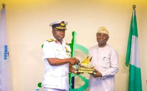
This was the focus of deliberations when the Hydrographer of the Nation, **Rear Admiral Olumide Fadahunsi**, paid a working visit to the NIMASA headquarters in Lagos.
Commending NIMASA’s sustained commitment to safer waterways, Rear Admiral Fadahunsi praised the Agency’s investments in navigational safety systems, stating that Nigeria stands to benefit significantly from aligning its maritime safety framework with local hydrographic intelligence.
He said, “NIMASA has continued to demonstrate leadership in maritime safety, and this gives the National Hydrographic Agency greater confidence to deepen our partnership. Hydrography is the backbone of safe navigation, and wider compliance with locally produced charts will drastically reduce navigational risks within our waters.”*
The Hydrographer of the Nation further stressed that collaboration between both agencies would unlock new opportunities for maritime development, adding:
“Our goal is to ensure that every mariner operating in Nigerian waters has access to accurate, reliable, and up-to-date hydrographic information. Strengthening this partnership is essential to achieving that vision.”
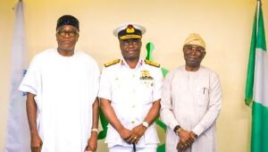
In his remarks, NIMASA Director General, Dr. Dayo Mobereola, reaffirmed the Agency’s commitment to improving hydrographic services, enhancing Maritime Safety Information (MSI) dissemination, and upgrading enforcement mechanisms to guarantee safer waterways.
Mobereola noted, “At NIMASA, we firmly believe that synergy among maritime institutions is key to achieving a world-class maritime safety regime. The National Hydrographic Agency remains a critical partner, and together we will elevate the standards of hydrographic service delivery in Nigeria.”
He added, “Our priority is to build a safer maritime environment by promoting data accuracy, strengthening operational capacity, and ensuring that navigational charts used in Nigerian waters meet international standards while reflecting local realities.”
The strengthened collaboration is expected to enhance maritime administration and reinforce NIMASA’s statutory mandate under the NIMASA Act to ensure safe and efficient navigation. This includes the deployment and enforcement of accurate, locally generated navigational charts essential for secure maritime operations across Nigeria’s territorial waters.